K3 Project 2024–2028
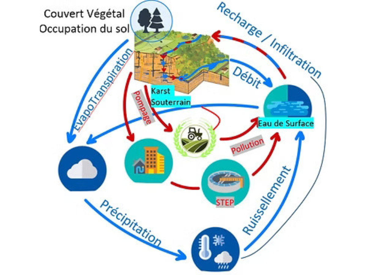
The K3 project aims to better understand and quantify the impact of climate change and anthropogenic pressures on water resources in karst hydrosystems, considering both groundwater and surface water.
Based on the study of three representative sites, it adopts an interdisciplinary approach combining field observations, hydrogeology, geochemical and microbiological analyses, remote-sensing tools, numerical modelling and socio-economic analyses. The aim is to improve understanding of how these complex systems function and contribute to the sustainable management of water resources in the face of global change.
This project is part of the OneWater – Eau Bien Commun National Research Programme, which aims to advance knowledge in the field of water, foster a paradigm shift and restore water’s status as a common good.
KEY FACTS
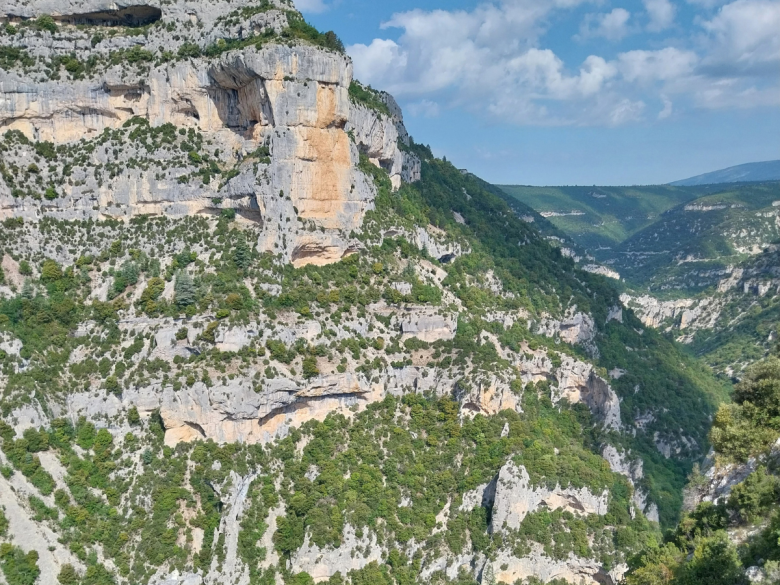
Why are karst hydrosystems of particular interest?
- They supply 40% of drinking water in France and approximately 25% worldwide
- Strong interactions between groundwater and surface water (SW–GW)
- Water flows at different speeds: rapidly through conduits, faults and fractures, and slowly through the carbonate matrix
- High sensitivity to climate change, making them “sentinels” of changes in the water cycle
- High sensitivity to pollution and flooding
PROJECT OBJECTIVES
Through an integrated approach encompassing all components of the water cycle...
K3 aims to better understand and quantify the impact of anthropogenic and climatic pressures on the quality and quantity of water resources in karst hydrosystems. Its goal is to provide decision-support tools and the knowledge required to help key users manage these resources appropriately.
The project is structured around three main areas—vulnerability, sensitivity and management—and adopts a multidisciplinary approach to advance water-management strategies tailored to karst hydrosystems.
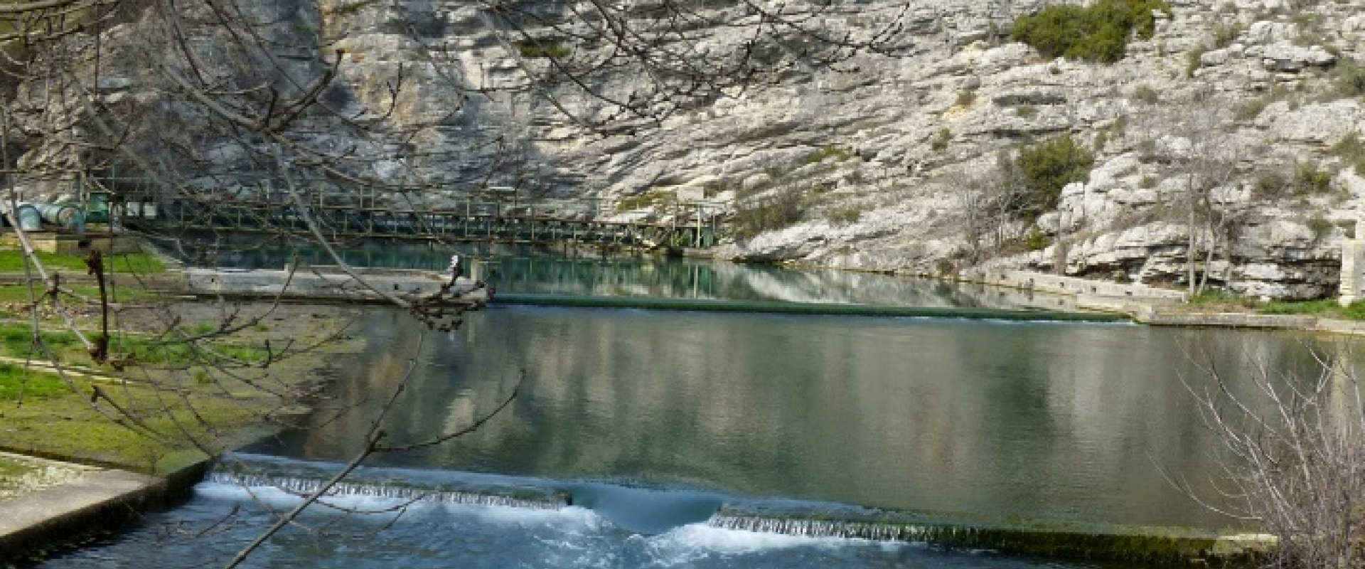
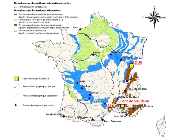
It aims to anticipate and prevent changes in the water reserves of three karst regions with diverse climatic, land-use, hydrogeological and socio-economic contexts: the Lez Spring (Montpellier), Fontaine de Vaucluse (Vaucluse and Alpes-de-Haute-Provence) and the Loue River (Jura).
espace K3
K3
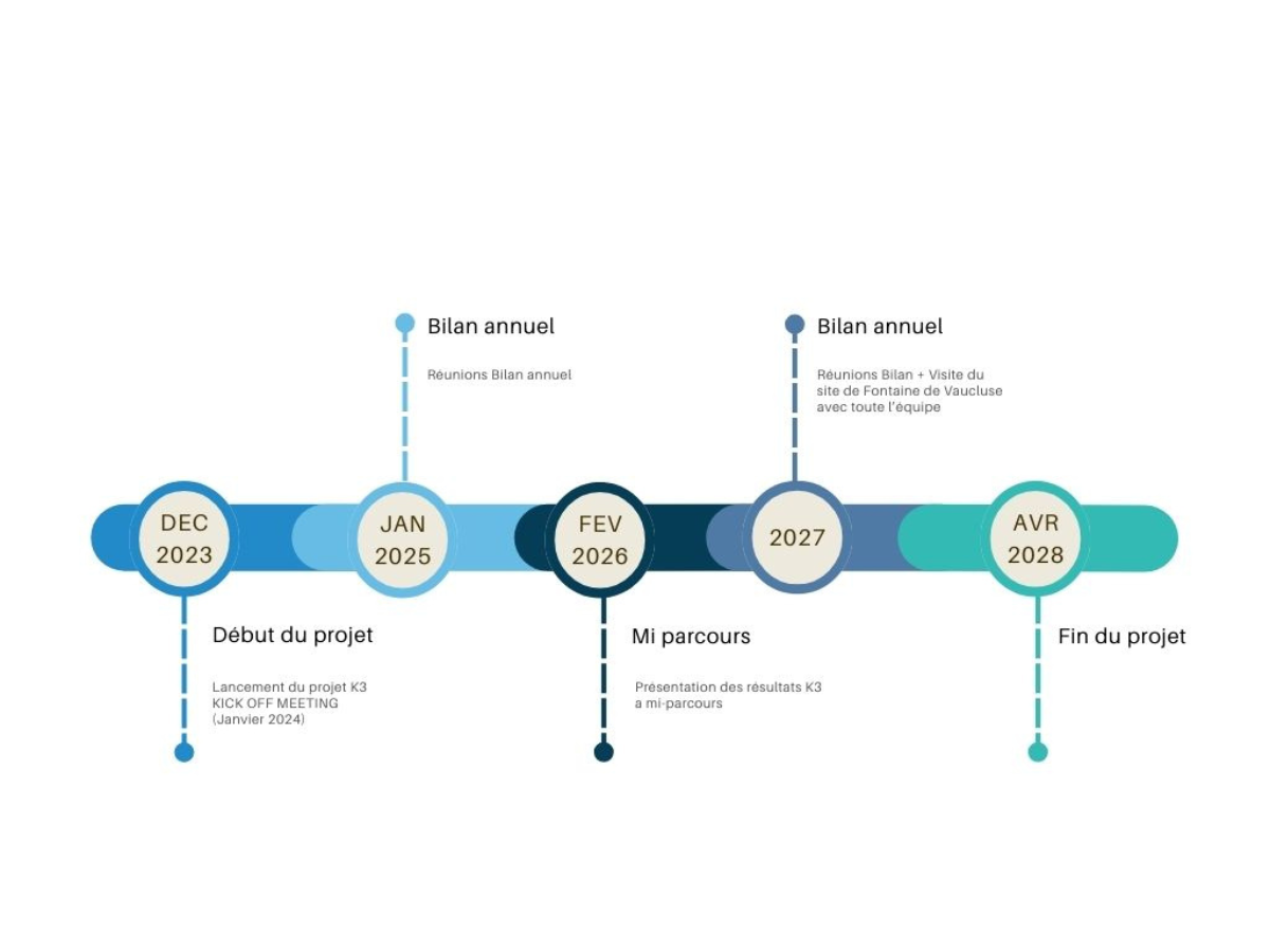
PROJECT DURATION
espace K3
K3
PROJECT OVERVIEW
The K3 project is one of the three projects selected through the OneWater – Eau Bien Commun programme’s 2022 Challenges / Cross-Challenge Call for Projects. Within the programme, K3 focuses on karst hydrosystems, whose strong surface water–groundwater interactions make them particularly sensitive to global change.
The overall objective of the K3 project (2024–2028) is to better understand and quantify the impacts of climate change on these hydrosystems and to propose adaptation solutions in response to various health and climate-related risks. It seeks to rethink resource-management practices through integrated approaches developed jointly by hydrologists, geologists, hydrogeochemists, microbiologists and socio-economists.
Current research focuses on three karst socio-hydrosystems characterised by contrasting anthropogenic pressures and different climates:
- The Lez aquifer, which supplies water to the city of Montpellier;
- The Loue watershed in the Jura region, where land cover and land use have changed significantly since the 17th century;
- The Fontaine de Vaucluse spring, which has the highest discharge in Europe and is currently a major tourist attraction.
espace K3
K3
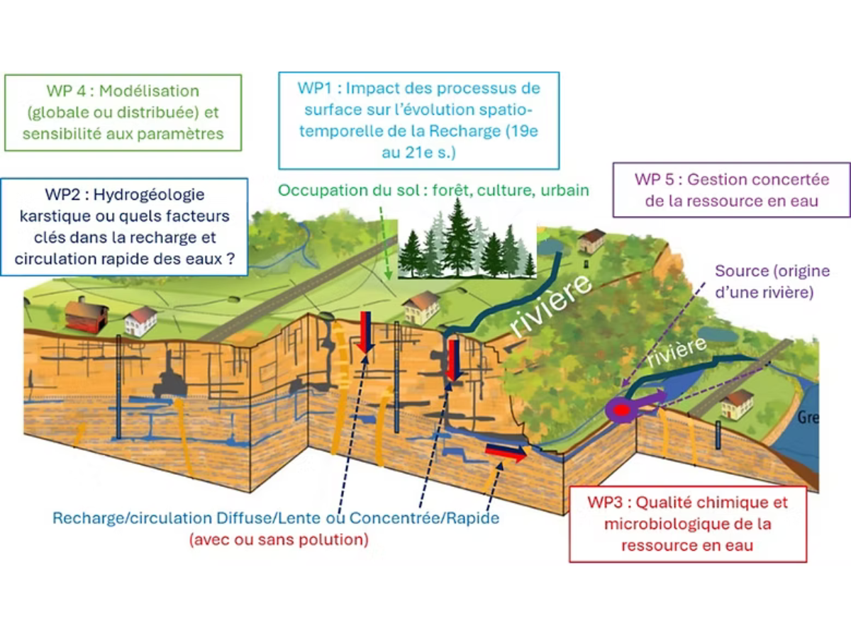
The K3 project is structured around five research areas to account for the specific characteristics of karst hydrosystems, from their infiltration zones to their outlets:
Research Area 1: Processes at the Soil–Vegetation–Atmosphere interface
Two approaches are currently being used to determine diffuse recharge in carbonate formations: (i) the first develops models of diffuse and preferential flow through karst soils to accurately represent plant water requirements and surface-flow dynamics. Initial results demonstrate the importance of preferential infiltration through fractures, which store water at depth throughout the year and support plant transpiration during periods of water stress; (ii) the second reconstructs maps of land-use change, from the earliest French General Staff maps produced in 1850 to 2023, to model the impact of these changes on recharge over almost two centuries.
Research Area 2: Development of karstification according to geological heterogeneity and recharge concentration
Multi-physics approaches—including geological, geomorphological, geophysical and speleogenetic methods—are applied to the studied features, such as faults and lithological heterogeneities. They help characterise the influence of faults on concentrated recharge and the organisation of underground drainage in Mediterranean karst systems. Meanwhile, reconstructing the evolution of plateau karsts through the study of poljes has led to the development of an initial conceptual karstogenetic model explaining the formation of karst systems in the Jura massif.
Research Area 3: Tracing the origin and transfer of contaminants within the aquifer
Hydrochemical analyses—including high-frequency monitoring and targeted sampling—combined with analyses of bacterial communities have revealed contamination peaks in autumn and spring. Initial results also confirm the relevance of studying organic-matter fluorescence for the development of an early-warning system. Antibiotic-resistant bacteria and other bacterial markers of anthropogenic contamination have been detected. Research is continuing to characterise overall bacterial diversity and its spatial and temporal dynamics.
Research Area 4: Developing distributed 3D and lumped hydrogeological models
Distributed and lumped models are being developed from multidisciplinary observations to test preferential recharge zones and improve predictions of changes in groundwater reserves. A spatially distributed inverse model of a karstified fault zone has been developed to reconstruct the hydraulic-conductivity field and the preferential karst pathways within this type of geological structure. Similarly, a lumped model testing recharge processes has been used to estimate the annual volumes flowing through active stream losses.
Research Area 5: Developing sustainable collaborative governance approaches
By working with all stakeholders—including institutions, water managers, water users and the scientific community—to improve the management of karst water resources, the project is establishing cross-sector dialogue and encouraging information sharing throughout its duration.
Ultimately, the project aims to provide science-based management tools that maintain a balance between water quantity and quality: enabling scientists to improve the parametrisation of their models; supporting operational stakeholders in developing protection and management policies; and helping users better understand the relationships between the different components, as well as the policies implemented, through their own involvement.